


Nearby Explorer app for iPhone and iPad
Developer: American Printing House for the Blind (APH)
First release : 03 Sep 2016
App size: 105.51 Mb
Thank you for your interest in Nearby Explorer. We are in the process of improving your wayfinding experience, and will be phasing out the paid version of Nearby Explorer in the near future. We suggest you consider installing Nearby Explorer Online (the free version of the app), which you will also find in the App Store.
Nearby Explorer is a full featured indoor and outdoor location app designed for use by people who are blind. Instead of just providing directions, it describes the environment in ways comparable to reading signage or observing road characteristics.
High quality onboard NAVTEQ maps are included, so a data connection is not required. If you do have a data connection, Nearby Explorer supplements the onboard maps with crowd collected points of interest from Foursquare or Google Places.
The onboard maps cover the United States and Canada, and contain millions of points of interest. The maps are over 4GB in size, so be sure the device you plan to use has enough available space before purchasing.
Nearby Explorer works with any device running iOS version 9 or later, but if the device does not contain its own GPS receiver, like most iPads and iPods, you must use an external GPS receiver. All iPhones contain GPS receivers. Indoors, in supported venues, it uses Bluetooth with supported beacons to determine your location.
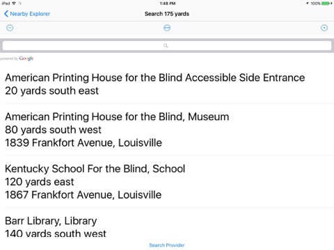
Nearby Explorer works by letting you select from several different location related options about what to announce as you move. These include both typical items like street name and address and specialized options like approaching streets, intersection configurations, and nearby places and the distance and direction to them. (All announcements are optional.) All of this information is shown on the home screen and is available at any time, but typical use is to adjust the level of announcements, then lock the screen and put the device away. This keeps both hands free and lets your preferred voice speak the characteristics of the environment as you move.
You may also use the devices position and orientation to obtain additional targeted details such as pointing the end of the device to scan for businesses, even in a moving vehicle, or tilting it vertically to function as a compass, including a listing of streets in the indicated direction. This all works with the device locked, so one need not fuss with the touch screen while moving. You may even mark a point, then use the position of the device to get haptic feedback about that points location.
Nearby Explorer includes a transit feature that provides detailed mass transit schedules for over 100 metropolitan areas in the U. S. and Canada. It treats transit stops just like favorites and points of interest by announcing their name and relative position as you move, but in addition, transit stops add next vehicle stop time, direction of travel, and route name to the announcements. You can use the transit schedules to look up times or even follow a route.
You may virtually move to any area in the U.S. or Canada and explore the road network, search, or use the transit maps for that area.
For complete details about Nearby Explorer, see http://tech.aph.org/ne
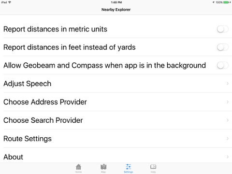
Continued use of GPS running in the background can dramatically decrease battery life